
Empowering Actionable
Insights Through AI
Total remote sensing solutions provider with organic space-based, aerial, and ground sensors coupled with AI-driven insights for industries that matter.
End-to-End Solutions
Core Expertise
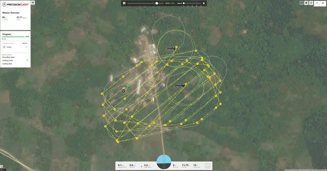
Multi-Sensor Data Collection
Space-based, manned aerial, unmanned aerial, and ground sensors for total coverage.
AI-Driven Analytics
Custom AI models for predictive insights, feature extraction, and real-time alerts.
Program Management
Full-cycle execution from tactical planning to outcome delivery and reporting.
Target Markets
Tailored remote sensing for critical industries.
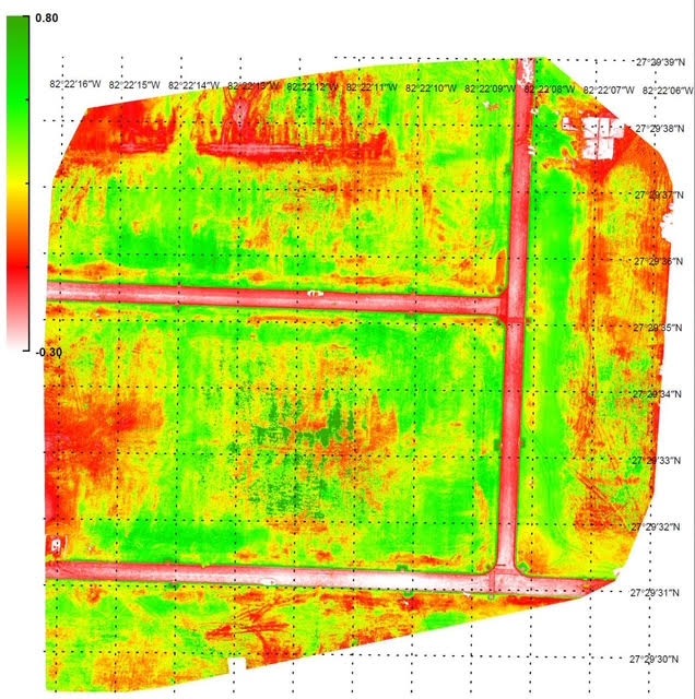
Precision Agriculture
Crop health, yield optimization, and irrigation management.
Environmental Monitoring
Real-time pollution tracking and regulatory reporting.
Natural Resources
Forestry, water, and land use analysis with integrated sensors.
Commodity Management
Supply chain insights and resource tracking.

Precision Engineering
Our sensors are calibrated for sub-meter accuracy in the most demanding environments.
The Technology Stack
Proprietary Assets.
Intelligent Outcomes.
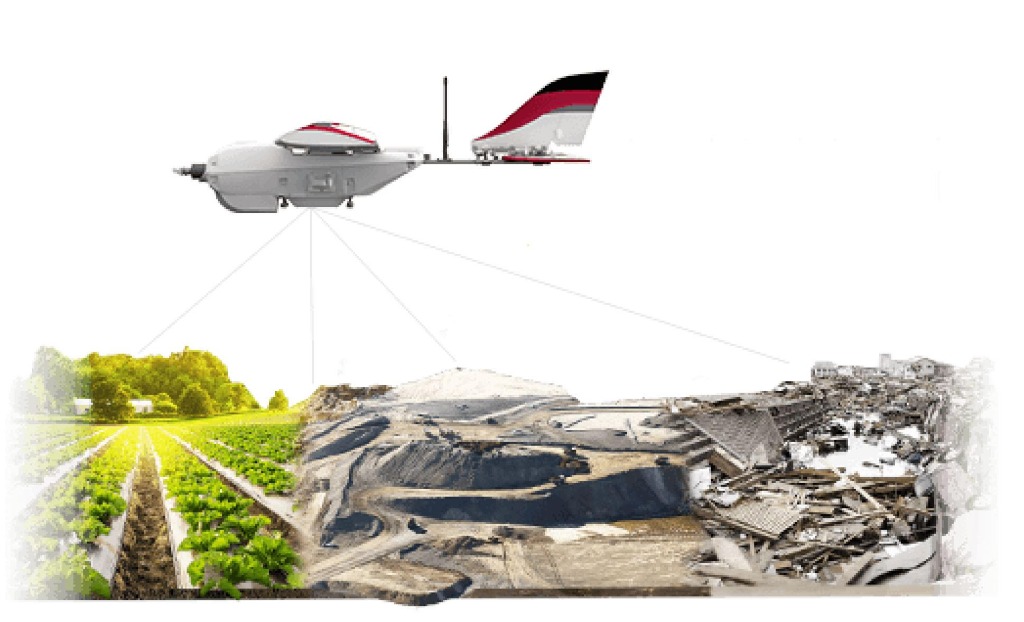
Organic Sensor Platforms
Multi-platform integration including proprietary space-based, aerial, and ground-level sensing hardware.
- Space-based monitoring
- Manned aerial payloads
- Unmanned aerial vehicles
- Unattended ground sensors
Proprietary AI Engine
Custom-trained machine learning models specifically designed for geospatial feature extraction and anomaly detection.
- Predictive yield modeling
- Feature recognition
- Automated compliance checks
- Change detection
GoldenEye Dashboard
A centralized command center for data visualization, program management, and outcome tracking.
- Real-time data visualization
- Integrated workflows
- Client collaboration tools
- Custom reporting
Real Impact.
Measurable Results.
We don't just provide data; we deliver outcomes. GoldenEye's integrated approach bridges the gap between raw remote sensing and decision-level intelligence.
Industry Leader
Recognized for excellence in AI-Geospatial integration 2025.
20%
Yield Improvement
Average increase in agricultural output for our precision farming clients through AI-optimized irrigation and nutrient management.
100%
Environmental Compliance
Zero regulatory violations reported for mining and industrial partners using our real-time pollution monitoring systems.
50k+
Hectares Monitored
Daily automated analysis of land use and forestry health across three continents using our satellite and aerial network.
Ready to Elevate Your Insights?
Join leading organizations using GoldenEye's total remote sensing solutions to drive sustainable growth and operational excellence.